Choropleth Map
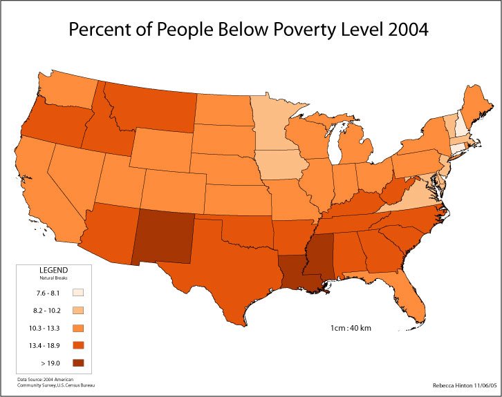
Choropleth Map - Wikipedia defines this map as a "a thematic map in which areas are shaded or patterned in proportion to the measurement of the statistical variable being displayed on the map, such as population density or per-capita income."
Dot Map
 |
Dot Map - According to www.earthonlinemedia.com, a dot map is one that "uses dots to illustrate the presence of the phenomenon on a map. A dot may equate to one or several units of measurement. Dot maps are especially useful in visualizing the frequency of occurrence or density of a mapped variable."
Isarithmic Map
 |
| Isarithmic Map - www.earthonlinemedia.com defines this map as a map that "uses isolines, lines that connect equal values, to illustrate continuous data such as elevation, air pressure, and precipitation." |
Proportional Symbol Map
 |
| Proportional symbol maps (also known as graduated symbol maps) are used in Cartography to visualize quantitative data associated with specific locations. For a given point on a geographic map, a symbol (usually a disk or a square) is scaled such that its area is proportional to the numerical value associated to the point. This scaled symbol is then placed at that point. (Source www.mappingignorance.org) |
|

No comments:
Post a Comment